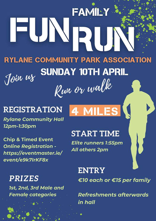
The Rylane Community Park Association (RCPA) are hosting a 4-mile fun run and walk on the 10th of April 2022 as a fundraiser for the development of the local community park playground.
There will be chip timing for this event with prizes for the male and female categories.
The start time is 2pm.
The 4-mile route goes through the village of Rylane, and it takes in the surrounding areas of Glounaglough and Knocknagoun. Water stops will be positioned at various points along the route.
Refreshments at Finish - Finishing bags and refreshments will be provided for all registered participants in the Rylane Community / Boxing Hall after the event.
The entry fee is €10 per participant, and €15 per family.
The link to the online registration is as follows: https://eventmaster.ie/event/e9k7IrKF8x
You can also enter on the day from 12 noon.
Location: The village of Rylane is located to the north-west of Cork City. As can be seen from the map above, it's located about 6kms west of Donoughmore.
The key roads from access for the R579 from Ballincollig / Cloghroe to Nad / Banteer and the R619 from Coachford to Bweeng. Look for the turn off which is the L2751 which is signposted for Rylane.
Course: The course is shown above and it takes in a loop near the base of the Boggeragh Mountains. The course is on quiet country roads and as can be seen from the elevation, it's gradually uphill for the first half and then downhill for the second half.
The start and finish is in the village by the new Community Park.